
| TOP>水質データ等流域図集 |
| 琵琶湖・淀川水質浄化研究所では、琵琶湖・淀川流域における水質保全の推進を目的に、面的に流域全体を一体的に俯瞰し、また、長期的な水質変化を捉えるため、主要河川において観測されている水質データをもとに、過去およそ20年間の変化の「見える化」を目指した長期的変遷図(GIS分布図)を作成しました。 整理対象とする項目は多岐にわたりますが、これまでの水質保全対策の評価や水質改善のための施策、さらに、新たな水質問題等について検討するためには、このような流域一体を捉えた状況把握は必要であり重要性は高いと考えています。本データ図表の公開によって、多くの方々が流域の水質保全についてより一層の検討や理解を深めることができますよう、有効に活用されることを願っております。 |
||
| 平成27年2月 (公財)琵琶湖・淀川水質保全機構 琵琶湖・淀川水質浄化研究所 |
||
|
||
| The Lake Biwa-Yodo River basin, covering 8,240 km² with a channel length extending 75.1 km, is a representative basin of Japan and encompasses six prefectures, including Mie, Shiga, Kyoto, Osaka, Hyogo, and Nara. Approximately 12 million people live in the basin, and Lake Biwa is a source drinking water for over 14.5 million people in the Kansai region. Until the latter half of the 20th century, rapid changes in society had deteriorated the water quality of the basin. An increase in sewerage plants, coverage area, and effluent regulations had contributed to reduce causes of water pollution and improved the water quality. However, over the past 20 years, changes in water quality have occurred due to changes in social structure, such as population growth and varieties of land use, as well as global climate change. To aid other studies, the Institute of Lake Biwa-Yodo River Water Environmental Research has prepared maps, which integrated local data including water quality and related data. These maps are available as available as analysis tools to consider water quality improvement, measures for future water conservation, and water environment management. These tools help to see conditions of the entire basin form a bird’s eye view. |
||
| Institute of Lake Biwa-Yodo River Water Environmental Research Dr. Keiko Wada |
||
 |
|
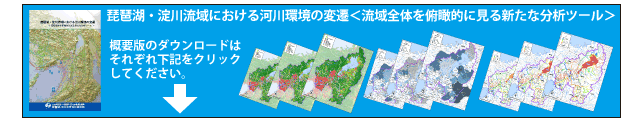
| ■ 概要版 -01 | [PDF 20.7MB] |
| …Ⅰ.はじめに / Ⅱ. 琵琶湖・淀川流域のあらまし / Ⅲ. 流域構造の変化 / Ⅳ. 気象の長期的変遷 | |
| ■ 概要版 -02 | [PDF 16.4MB] |
| …Ⅴ. 水質の変遷 / Ⅵ. 水質変化と下水道整備 | |
| ■ English Edition -Vol.1 | [PDF 7.5MB] |
| …Ⅰ.Introduction / Ⅱ.General Outline of Lake Biwa-Yodo River Basin / | |
| Ⅲ.Changes in Basin Composition / Ⅳ.Climate Changes / Ⅳ.Climate Changes | |
| ■ English Edition -Vol.2 | [PDF 10.2MB] |
| …Ⅴ.Change in Water Quality /Ⅵ.Change in Water Quality and Wastewater Treatment | |
| 図をご利用になる前に、こちら を必ずお読み下さい。 |
| |
| 水温 | (年間平均) | |||||
| (夏季平均:7~9月) | ||||||
| (冬季平均:1~3月) | ||||||
| (夏季最高:7~9月) | ||||||
| (冬季最高:1~3月) | ||||||
| (冬季最低:1~3月) | ||||||
| pH | (年間平均) | |||||
| (夏季平均:7~9月) | ||||||
| (冬季平均:1~3月) | ||||||
| DO | (年間平均) | |||||
| (夏季平均:7~9月) | ||||||
| (冬季平均:1~3月) | ||||||
| SS | (年間平均) | |||||
| BOD | (年間平均) | |||||
| COD | (年間平均) | |||||
| 大腸菌群数 | (年間平均) | |||||
| COD/BOD比率 |
||||||
| 日平均気温 | (年間平均) | |||||
| 日最高気温 | (年間平均) | |||||
| 日最低気温 | (年間平均) | |||||
| 気温 | (夏季最高:7~9月) | |||||
| (冬季最高:1~3月) | ||||||
| (冬季最低:1~3月) | ||||||
| 年間降水量 | ||||||
| 豪雨発生頻度(30mm/時以上) | ||||||
| 累積積雪量 | ||||||
| 人口 | ||||
| 人口密度・人口集中地区 | ||||
| 土地利用 | ||||
| 下水道普及率 | ||||
| 下水処理場分布 | ||||